Maps
-
Maps
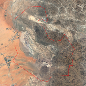
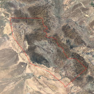
11_A Concession – Maps Package
299,000 $ Add to cartPackage Includes
The concession boundary is illustrated in the preview image. The dataset includes the following high-resolution maps:
• Geological Map with complete legend (TIFF & PNG)
• Lithology Map derived from ASTER remote sensing (TIFF & PNG)
• Lithology Map derived from Landsat-8 remote sensing (TIFF & PNG)
• Lithology Map derived from Sentinel-2 remote sensing (TIFF & PNG)Coordinate System: EPSG:4326 – WGS 84
-
Maps
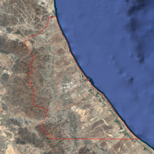
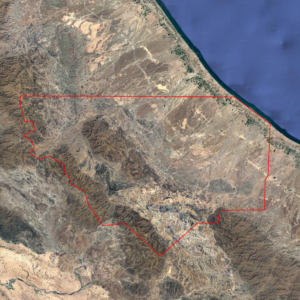
11_B Concession – Maps Package
430,000 $ Add to cartPackage Includes
The concession boundary is illustrated in the preview image. The dataset includes the following high-resolution maps:
• Geological Map with complete legend (TIFF & PNG)
• Lithology Map derived from ASTER remote sensing (TIFF & PNG)
• Lithology Map derived from Landsat-8 remote sensing (TIFF & PNG)
• Lithology Map derived from Sentinel-2 remote sensing (TIFF & PNG)Coordinate System: EPSG:4326 – WGS 84
-
Maps
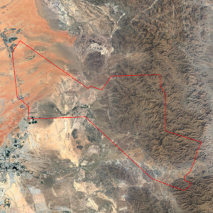
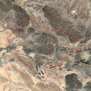
11_C Concession – Maps Package
229,000 $ Add to cartPackage Includes
The concession boundary is illustrated in the preview image. The dataset includes the following high-resolution maps:
• Geological Map with complete legend (TIFF & PNG)
• Lithology Map derived from ASTER remote sensing (TIFF & PNG)
• Lithology Map derived from Landsat-8 remote sensing (TIFF & PNG)
• Lithology Map derived from Sentinel-2 remote sensing (TIFF & PNG)Coordinate System: EPSG:4326 – WGS 84
-
Maps
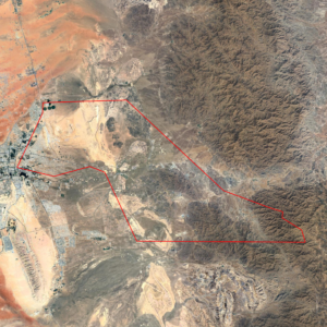
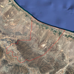
11_D Concession – Maps Package
270,000 $ Add to cartPackage Includes
The concession boundary is illustrated in the preview image. The dataset includes the following high-resolution maps:
• Geological Map with complete legend (TIFF & PNG)
• Lithology Map derived from ASTER remote sensing (TIFF & PNG)
• Lithology Map derived from Landsat-8 remote sensing (TIFF & PNG)
• Lithology Map derived from Sentinel-2 remote sensing (TIFF & PNG)Coordinate System: EPSG:4326 – WGS 84
-
Maps
12_A Concession – Maps Package
445,000 $ Add to cartPackage Includes
The concession boundary is illustrated in the preview image. The dataset includes the following high-resolution maps:
• Geological Map with complete legend (TIFF & PNG)
• Lithology Map derived from ASTER remote sensing (TIFF & PNG)
• Lithology Map derived from Landsat-8 remote sensing (TIFF & PNG)
• Lithology Map derived from Sentinel-2 remote sensing (TIFF & PNG)Coordinate System: EPSG:4326 – WGS 84
-
Maps
12_B Concession – Maps Package
280,000 $ Add to cartPackage Includes
The concession boundary is illustrated in the preview image. The dataset includes the following high-resolution maps:
• Geological Map with complete legend (TIFF & PNG)
• Lithology Map derived from ASTER remote sensing (TIFF & PNG)
• Lithology Map derived from Landsat-8 remote sensing (TIFF & PNG)
• Lithology Map derived from Sentinel-2 remote sensing (TIFF & PNG)Coordinate System: EPSG:4326 – WGS 84
-
Maps
13_A Concession – Maps Package
380,000 $ Add to cartPackage Includes
The concession boundary is illustrated in the preview image. The dataset includes the following high-resolution maps:
• Geological Map with complete legend (TIFF & PNG)
• Lithology Map derived from ASTER remote sensing (TIFF & PNG)
• Lithology Map derived from Landsat-8 remote sensing (TIFF & PNG)
• Lithology Map derived from Sentinel-2 remote sensing (TIFF & PNG)Coordinate System: EPSG:4326 – WGS 84
-
Maps
13_B Concession – Maps Package
220,000 $ Add to cartPackage Includes
The concession boundary is illustrated in the preview image. The dataset includes the following high-resolution maps:
• Geological Map with complete legend (TIFF & PNG)
• Lithology Map derived from ASTER remote sensing (TIFF & PNG)
• Lithology Map derived from Landsat-8 remote sensing (TIFF & PNG)
• Lithology Map derived from Sentinel-2 remote sensing (TIFF & PNG)Coordinate System: EPSG:4326 – WGS 84